Presented without comment: "(In case you were wondering, it would take a roller-grill hot dog 76 years and 256 days to travel the entire trail network.)"
True. Wanted to see the map right away so googled for it before reading all the way through. Ended up spending time on the map and forgot about the article till later. I guess that is why the author put the map link at the very end of the article. A map image at the start of the article might have kept people reading.
FYI, this is apparently what used to be referred to as the Trans-Canada Trail. I have a poster I picked up ages ago; it was probably around the time that the trail was first being promoted.
Note that "connected" is somewhat euphemistic (and controversial). [1] A lot of the trail is unsegregated shoulders of highways.
Wow, at least the P.E.I. government has revised their Trans Canada Trail guide, which said you would never need to leave the trail...
We got to Prince Edward Island which was supposed to be the safest place in Canada to cycle, and the afternoon we arrived we were riding on the Trans Canada Trail, the trail guide took us off the trail, we did 2.9 kilometres on a highway, and she was struck by a drunk driver and killed.
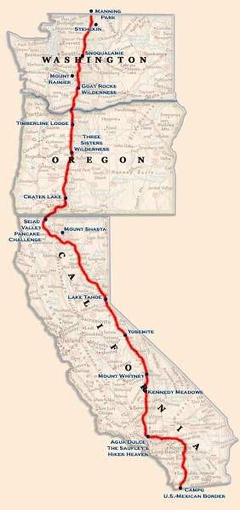
>It’s almost four times as long as the Grand Italian trail, which covers all of Italy. It’s also over five times as long as the West Coast’s famed Pacific Crest Trail, and over six times as long as the Appalachian.
the difference being that the pacific crest trail, the appalachian trail, and the grand italian trail are all actually trails rather than just lines on a map. The trans canada trail isn't a real thing, it's just some marketing people looking at maps, saying "this probably counts as a trail, right" and then calling the job done.
the trans-canada "trail" includes creeks, four-lane highways, and unmaintained deer tracks.
It’s not exactly a through hiking type of trail, but something you would do sections of. I see no problem that it includes water passages and what not, choose the recreation type you want and go get it.
the problem with it including waterways is that words have meaning, and "trail" and "waterway" are words that mean different things.
it's cool that they include waterways in their map. my problem is that they don't call it the "canada-wide recreation areas network", they call it a trail. and it isn't.
Well it's not a network, it's a route across the country.... AKA a trail. Plenty of trails are or include waterways, "trail" != "hiking trail". Canada is especially rugged, rivers are the best way through large parts of it.
Hmm... I checked the dictionary. I think this qualifies? I checked because I agreed with you, though I wasn't sure of the actual definition. A waterway could also be called a trail.
looking around the map near me for an example, there's a section of trans canada "trail" from olds to airdrie that is just highway 2A travelling in a dead straight line for about 100km.
This is definitely not true. Are you thinking of the California Coastal Trail?
Highway 1 runs directly on the coast. The PCT runs along the crest of the Sierra Nevada and Cascade mountain ranges-- more than 100+ miles to the east of Highway 1.
I'm not that cynical. A lot of work went into getting it to this point and they're not just calling in "done." That said, there appears to be an awful lot of road walking compared to most other official long distance trails, even if those do sometimes have sections of road here and there.
Additionally, much of the actual "trail" in it is rail-to-trail conversions, flat stretches with private farm land on both sides. Not exactly an exciting hike.
No trails that go these kinds of distances are "exciting" all the time. Fairly hard to hike across Canada without going through the prairies for example. :)
Another thing is that it is quite stupidly routed in some areas with real trails.
As a reasonably experienced long distance hiker, and being from Canada when I heard about the trail nearing completion my first though was, can I through hike this. I looked into the logistics of doing this in about a year of hiking . Crux would be getting out of the North and mountains and into SK for winter.
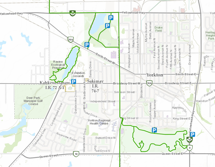
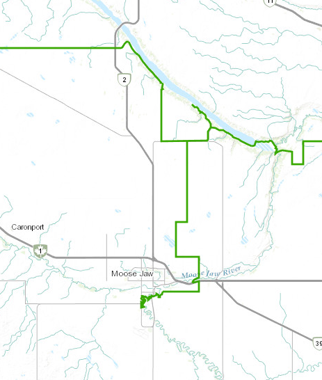
Anyway, my first thought was damn there is a lot of road walking up north. Then I decided to see what it looked like when it ran through the town I grew up in, take a look: http://se.ri0.us/2017-09-02-134045614-af037.png
Notice how part of the 'trail' isn't even connected to the rest, how it does a lollipop in the southeast
I get that its a connection of recreational trails and some of the weird routing is because the town's local trails are not meant to be trails 'to' somewhere but really, this is just bad design.
As the trail does lollipops and has dead-ends I really don't think its fair to compare its length to more proper trails that one could reasonable follow end to end without needing to hike segments multiple times (there and back).
I really wish The Great Trail was an awesome, trans-Canada hike, I really do, buts its just a great disappointment to me.
I think funding/support this trail had would have been better spent on some of the amazing trails Canada has like the Great Divide Trail.
> A quarter of this length is water—wetland and river routes where hikers will have to trade boots for boats.
This is another problem. If you think you could do this entirely by human power, you're wrong.
Zoom in on Vancouver, and the trail crossing the water across the Burrard Inlet in a zone where non-motor-powered boats are ILLEGAL (between the two bridges is the port, cruise ship terminals, and a busy float plane airport. No kayaks or paddle boards or sailing allowed.
You'd think they'd plot a path in the 3rd largest city in Canada that is navigatable by kayak.
Trail has been in place for years. What this is is the end of a decades-long debate about trail use. Parts of the trail were once open to motor vehicles (quads, logging roads etc) and some people dont think that should count. Note the very specific language about use, that snow machines are allowed in winter and horses in summer. Some trails are also on private land, where limitation on use gets complicated. This the end of a long debate between specific parties not the physical completion of any great work.
I recently spent some time trying to figure out the furthest north you can drive in Canada by car (or at least without a float plane), and what there is to do up there. It's actually pretty interesting. Apparently you can get up to James Bay via the James Bay Road and the Trans Taiga Highway, but there isn't any way to actually get up to Hudson Bay without a boat or a float plane. It's crazy how much of the country is basically unexplored. Apparently over 90% of the lakes don't even have names, so you can name a lake if you want to be the first person to visit it.
I think the furthest north you can drive is probably Whitehorse in Yukon [EDIT: not BC] on the Pan-American Highway. But presumably you were looking at the eastern end of Canada.
[ADDED: As someone else noted, you can keep going north of Whitehorse with the Pan-American Highway eventually crossing the border with Alaska or the Dempsey Highway.]
That's a beautiful drive. I passed through on my way to Alaska a few years ago. It had some of my favorite stops ever...sometimes just stopping and parking the RV at a pull off even led to gorgeous scenery. One of my favorite hot springs (Liard) is on that route. So many bears and moose and other critters, too.
A few years ago I road the section from Magog to Montréal, QC which is part of Quebec's "Route Verte". This stretch was completed separate from highways and only occasionally crossed roads. What I noticed most was that it was nowhere near the fastest way to travel because it often went in a round about route instead of following a straight line. The section near Mont Orford was likely the slowest bike path I've been on, followed by a section near Waterloo, Quebec which was a converted rail line which was likely the fastest. The lack of straight lines may be part of the reason why there's 21,000km of trail when you can bike from St. John's to Victoria in just 7,000km.
Man, I'm going to traverse this thing if I can. I wonder how long it would take to walk it (and boat somehow, don't think you could swim it). Probably not practical on foot, about two years of ten-hour days maybe, and that's in good weather.
Added:
Looks like somebody has already done the whole east-west leg.
There's a guy[1] who has been working on hiking it all for a couple of years. I think he just has a bit of the journey from somewhere in the Yukon to the Arctic Ocean left.
reply